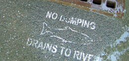
Stormwater in Our Region
Stormwater is vital for replenishing waterbodies, particularly in the Metro Water District, where most drinking water originates from surface water. Proper stormwater management enhances our drinking water quality, improves treatment efficiency, and maintains healthy streams, rivers, and lakes for wildlife and recreation.

Tips to Protect Our Water
Access to clean water is important for our wellbeing. We all play an important role in protecting water quality and watershed health. Learn simple actions you can take to keep our water sources clean.

Wastewater in Our Region
Wastewater is water that has been used in homes, industry, and businesses and released back into the environment after being treated at a facility or within a self-contained septic system. Effective infrastructure and wastewater treatment planning across our region supports the return of safe, high-quality water to our rivers and reservoirs.

Find Your Watershed
A watershed is the land that drains into a stream, river, lake, or other body of water. Use the Metro Water District’s Digital River Basin Profiles to learn more about your watershed.

EPA Stormwater Calculator
EPA’s National Stormwater Calculator (SWC) is a software application tool that estimates the annual amount of rainwater and frequency of runoff from a specific site using green infrastructure as low impact development controls. The SWC is designed for use by anyone interested in reducing runoff from a property, including site developers, landscape architects, urban planners, and homeowners.
