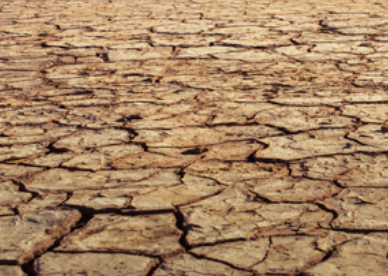
Drought Status
Every Drop Counts!
Stay aware of current drought conditions in our area and do your part to conserve water! Follow our tips for maintaining your lawn during drought.


The U.S. Drought Monitor provides timely and understandable scientific information on water supply and drought in our region.

Compare our actual monthly rainfall to each month’s average over the last 13 months.

The Lawn-and-Garden Moisture Index indicates soil moisture across the District. Areas that show red do not have sufficient moisture to support healthy lawns and gardens.

The USGS Georgia Water Conditions page provides real-time and recent data on streamflow, groundwater levels, precipitation, and water quality from monitoring sites across the state, helping users track current conditions and trends.

NOAA and NWS 12-hr probability of precipitation in localized areas of the metro region forecasts show a range of probability for the following week.
There is currently a statewide Level 1 Drought declared in Georgia. Be sure to follow the state’s year-round watering restrictions which limit outdoor watering to before 10 a.m. and after 4 p.m.

An interactive tool for exploring the watersheds within the Metropolitan North Georgia Water Planning District.

Watches, warnings, and advisories page lists any hazardous weather conditions issued by the National Weather Service in the region.
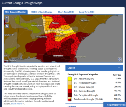
The Georgia Drought Dashboard provides current drought conditions across the state through maps and data, allowing users to track conditions and view historical trends.


